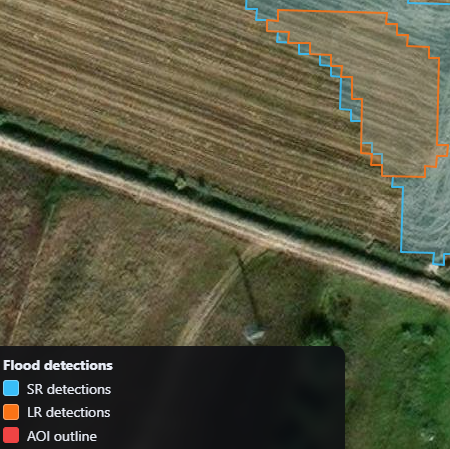
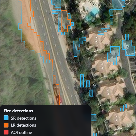
Super-Resolution: Spectral Validation for Flood 🌊 and Fire 🔥
This interactive visualization evaluates the impact of super-resolution on downstream spectral analysis tasks using Sentinel-2 imagery. The results are generated with the OpenSR latent diffusion model in combination with SEN2SR , a spectrally consistent super-resolution framework designed for Earth-observation data.
The maps compare low-resolution inputs against super-resolved outputs for two real-world use cases: flood-water delineation and burn-scar mapping. Rather than emphasizing visual sharpness alone, the focus is on how improved spatial detail influences the structure and coherence of spectral index responses used in operational remote-sensing workflows.
The full implementation, data processing pipeline, and evaluation code are available in the OpenSR spectral use-cases repository .